5/6

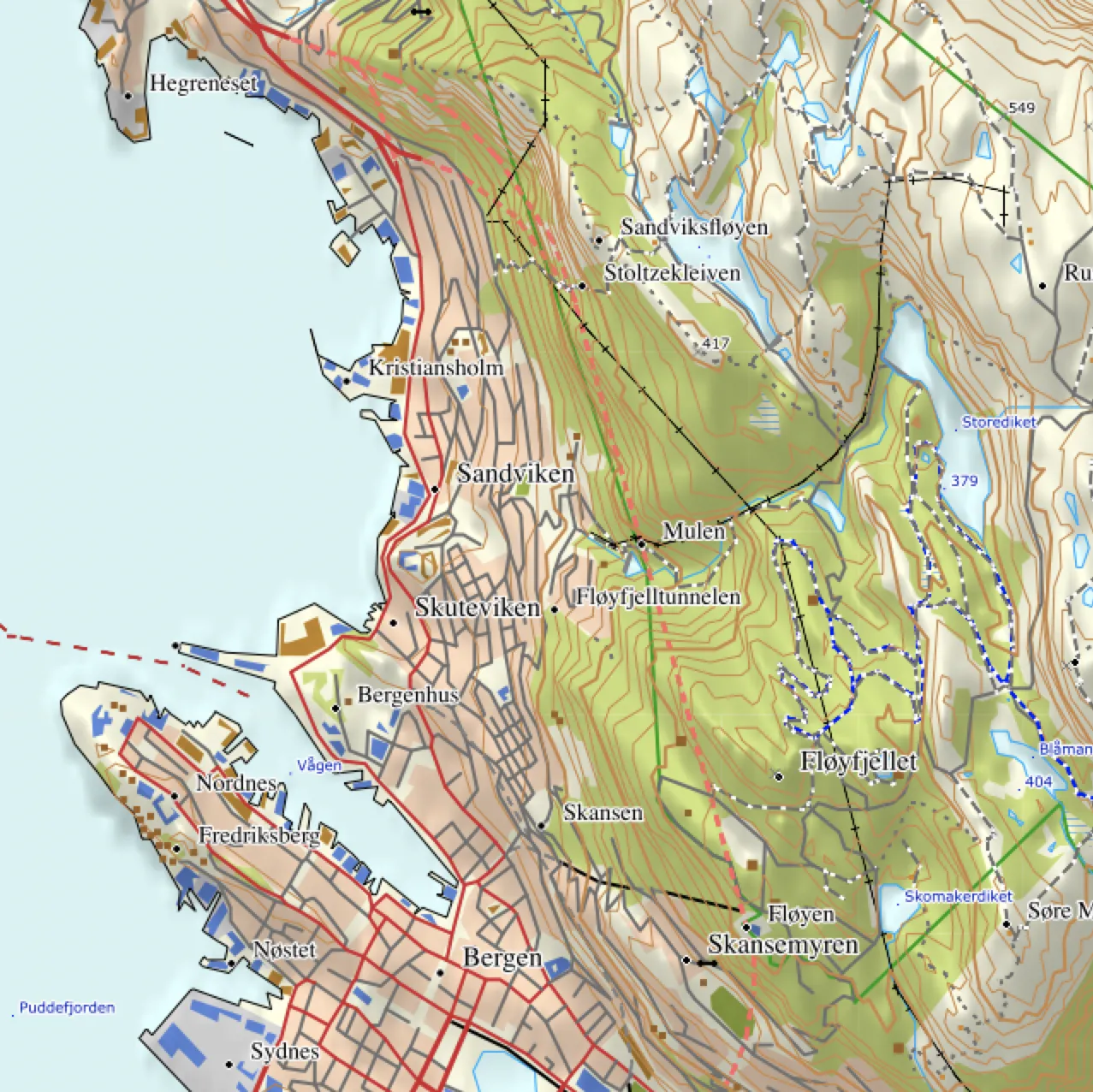
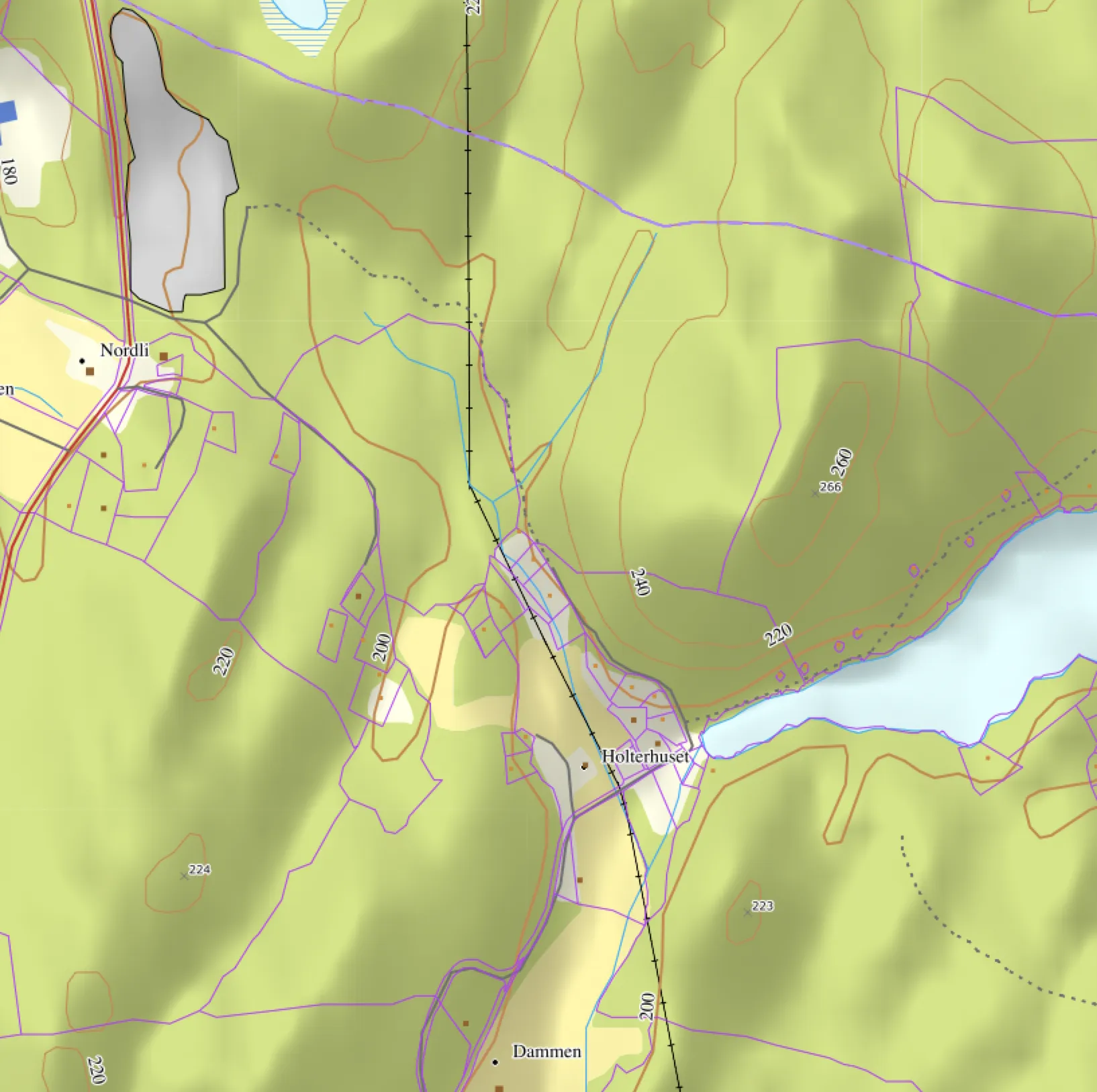
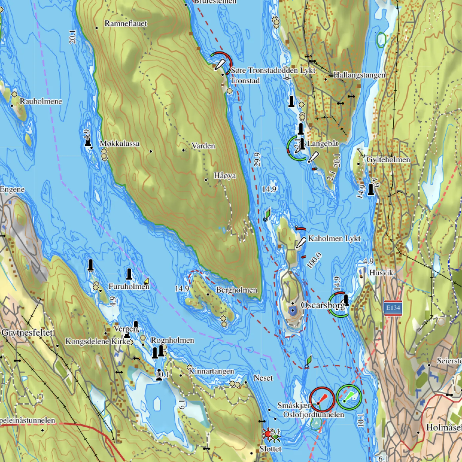
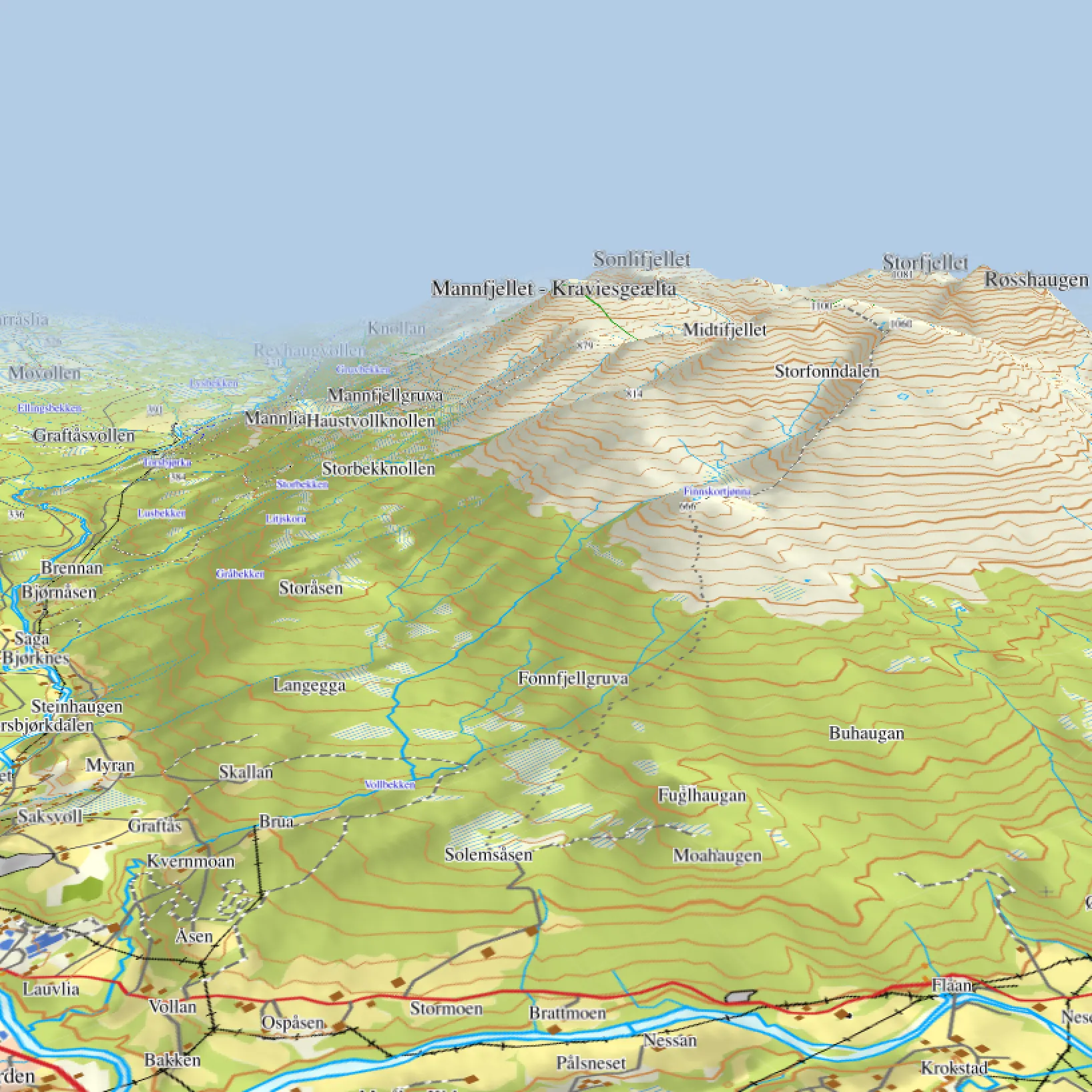
This is a topographic map over Norway for Garmin® GPSer. Created from the Norwegian Mapping Authority 1:50 000 mapping data. This is perfect for trips both in the woods and on the mountain.

  • You get:
  • Download immediately

    After you have paid for the map you can download the map immediately. You can then either install map on BaseCamp or directly on your GPS or Memory card.

  • DNT ruter

    DNT routes and cabins

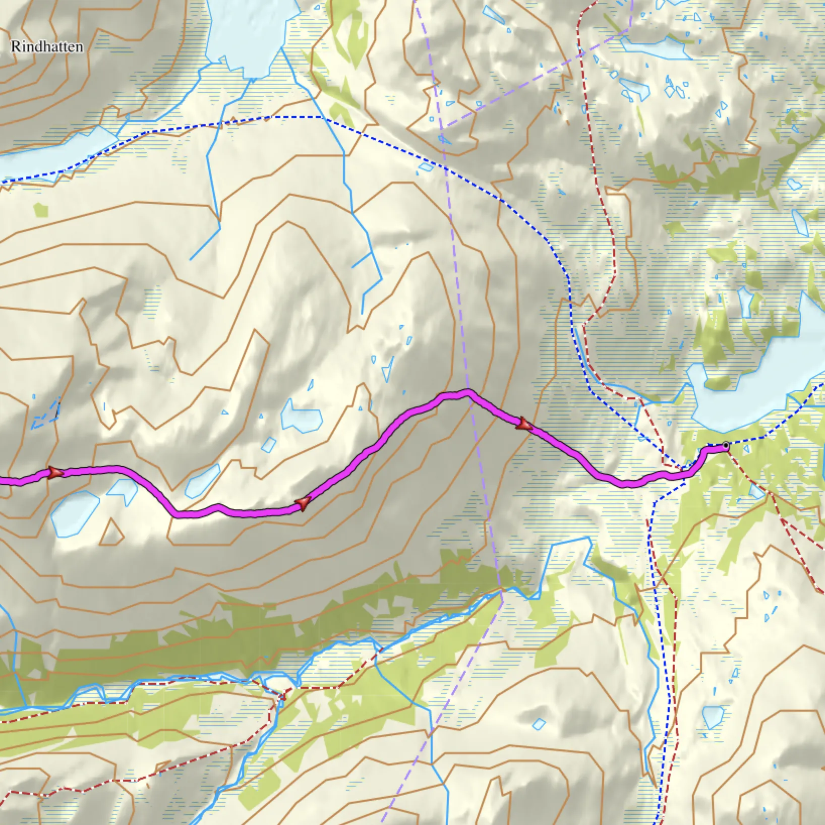
    The Norwegian Trekking Associations (DNT) cabins and trails are included in the map. So that you can easily find your path.

  • Image

    Steepness map for skiers

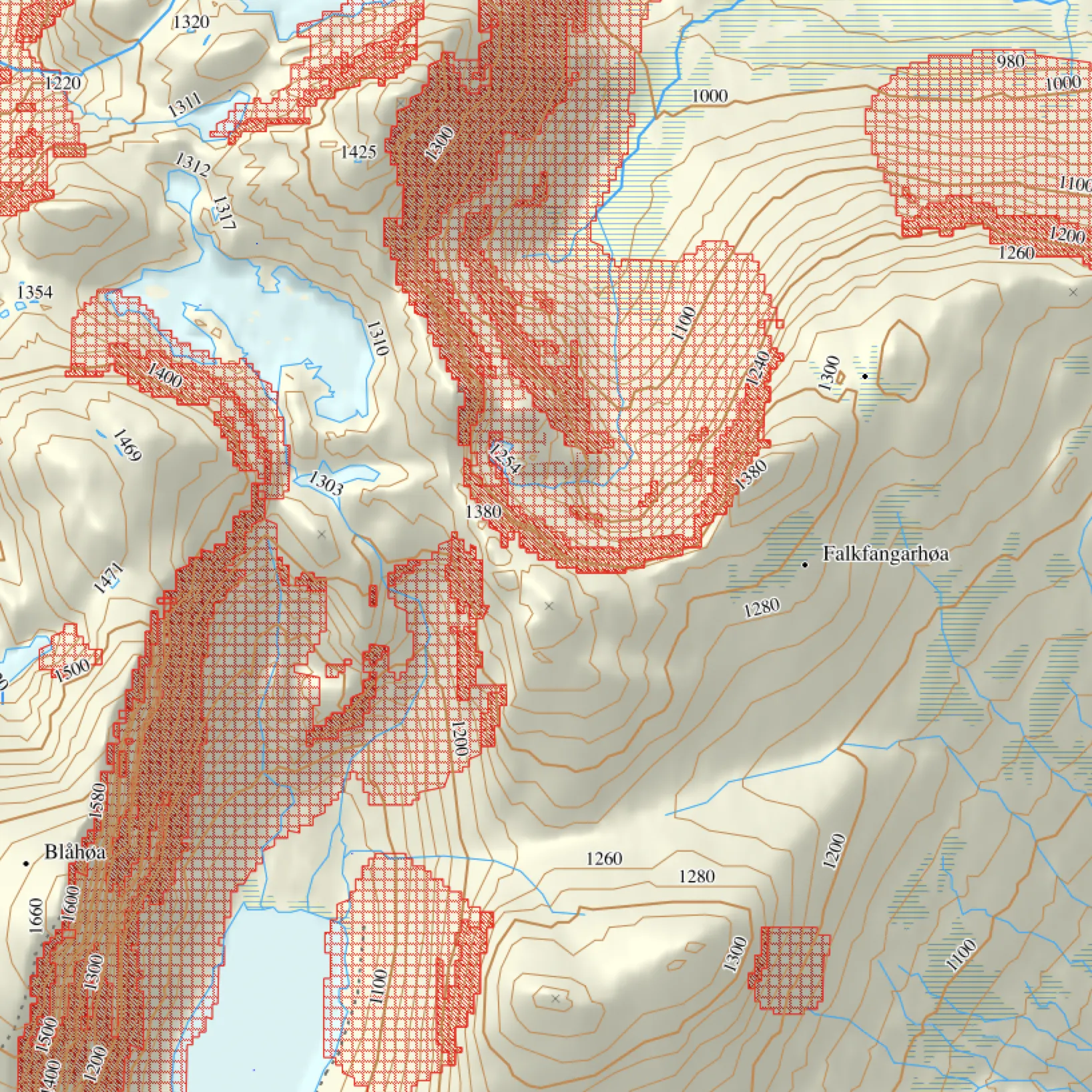
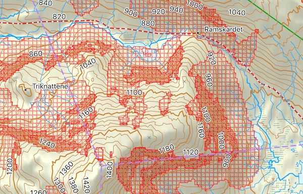
    Be safer on tour with steepness map. The map marks the steepness of the terrain, so that you can assess avalanche danger.

    If you buy N50 Norway you can download maps with and without steepness, all included in the price. Avalanche map may also be installed simultaneously on the GPS. You can install the maps on your GPS as a separate layer, to make it available all the time.

    The map is calculated from a height model with 10 meter horizontal solution. Smaller slopes may therefore not be visible on the map.

  • Image

    Avalanche awareness map

    Alternatively, you can use the avalanche awareness map. The map marks avalanche risk areas and is based on NVEs avalanche awareness map.

  • Kart med grenser

    Property boundaries

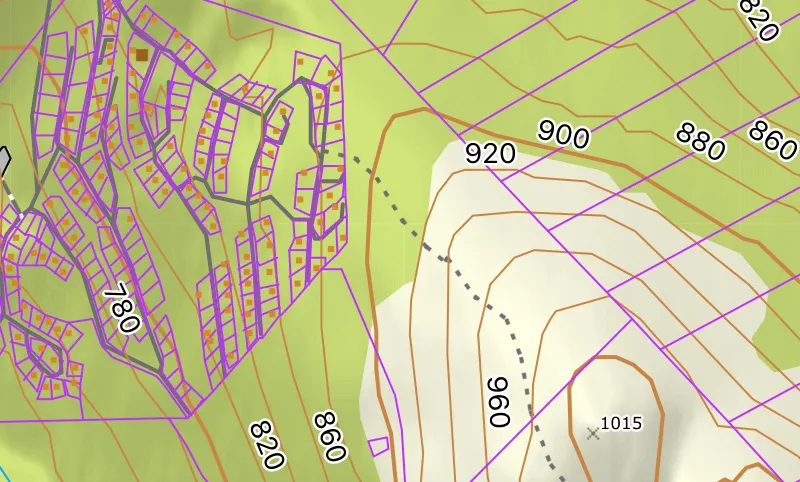
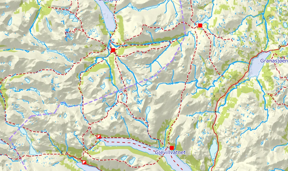
    You can choose to purchase maps with property boundaries. So you always know where borders in hunting area goes. You can easily switch between showing and hiding property boundaries of your GPS.

  • Kart med grenser

    Maritime details

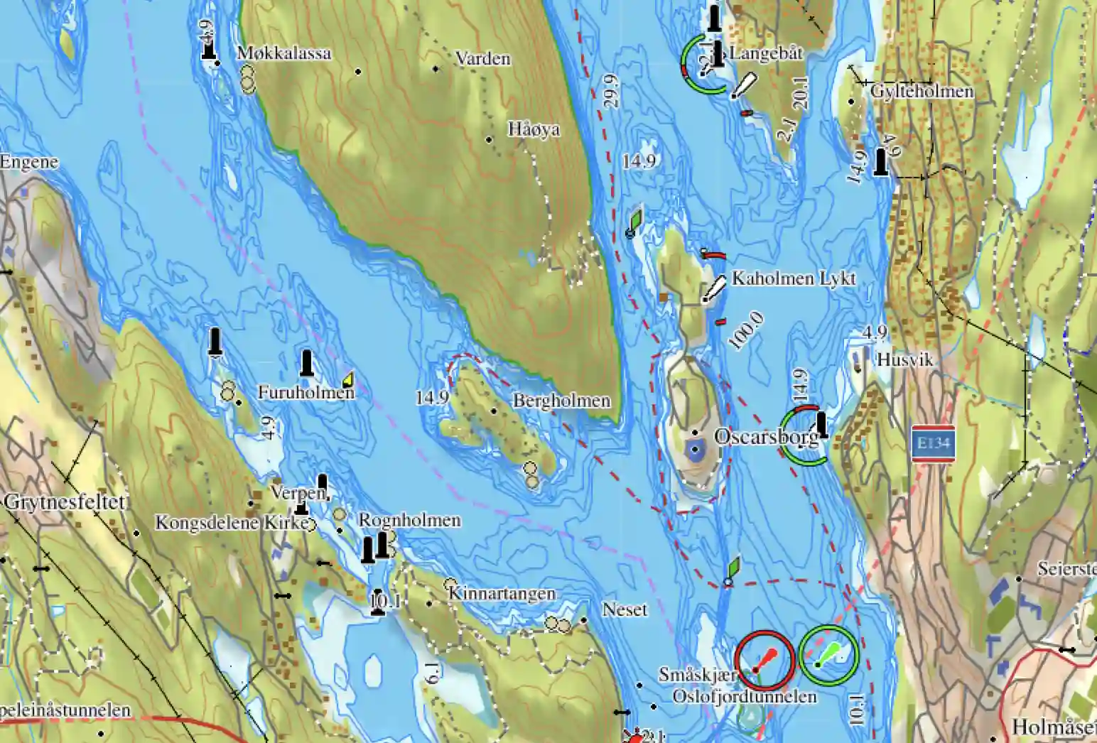
    You can choose to buy a map with maritime details. The map is an optional map layer. The map is not suitable for navigation on seas. It contains, ocean dept, light houses, poles and other navigation aids. The map is suitable for kayak paddlers and as a support to paper maps. The map can not be installed on marine chart plotters.

  • 3D kart

    3D map in BaseCamp

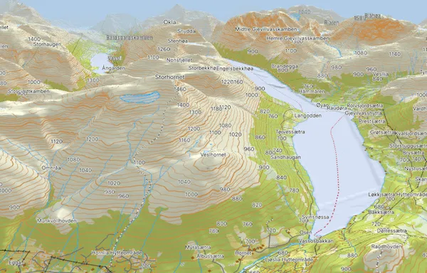
    View map with 3D viewing in BaseCamp and the shading on your GPS.

  • 3D kart

    5 meter elevation curves

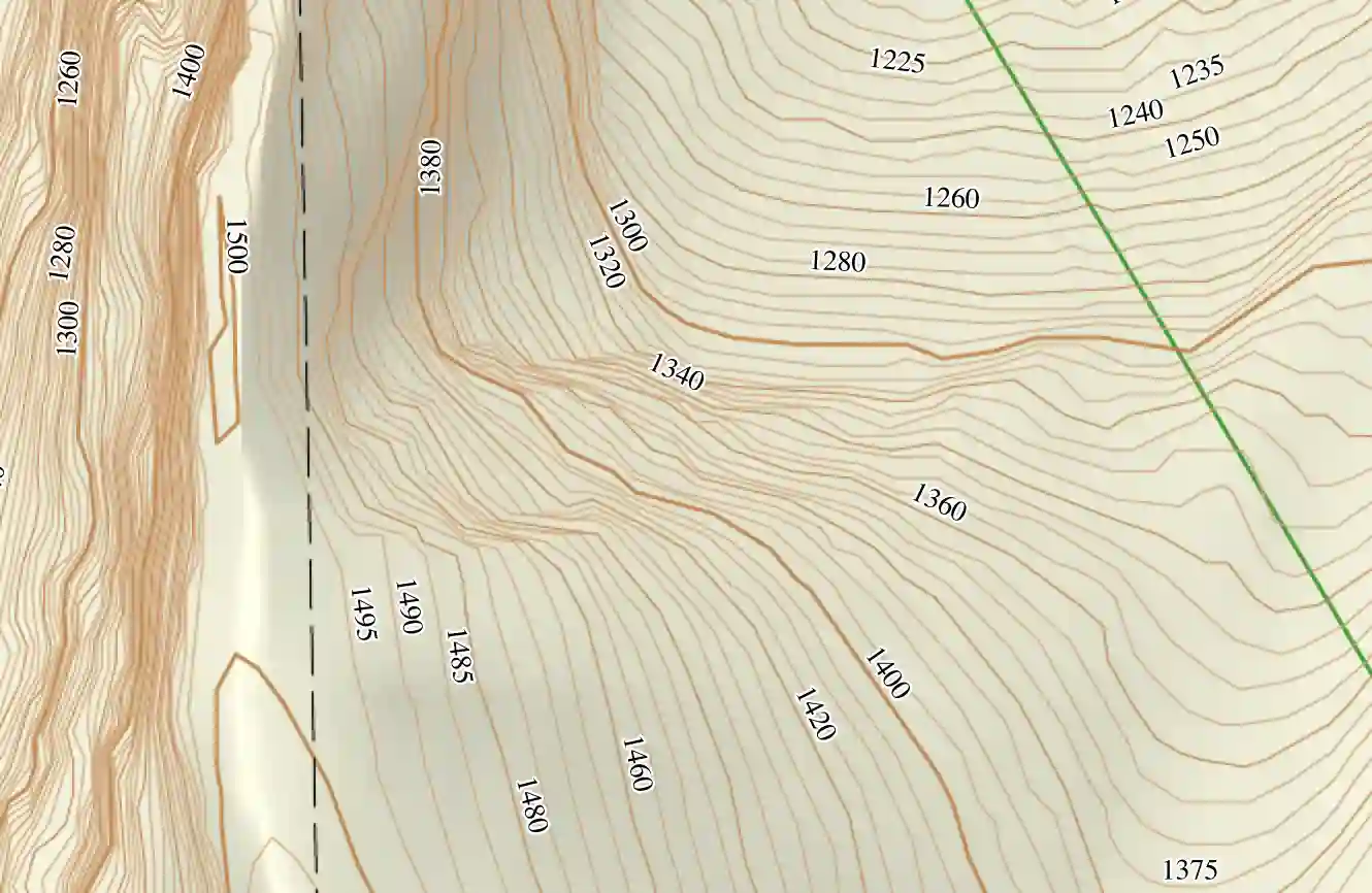
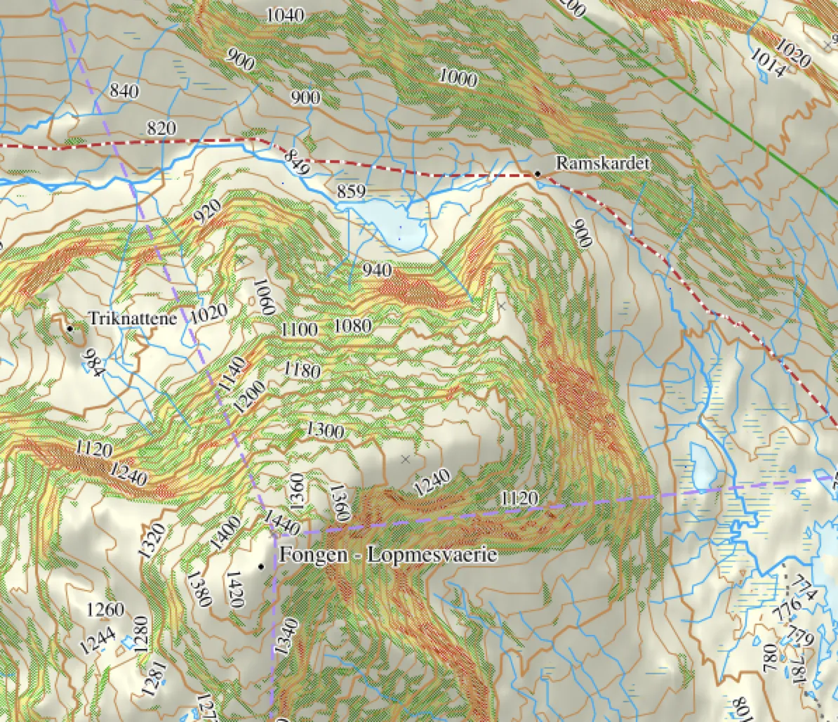
    Elevation curves are shown with 5 meter interval (equidistant).

  • Image

    Active route planning

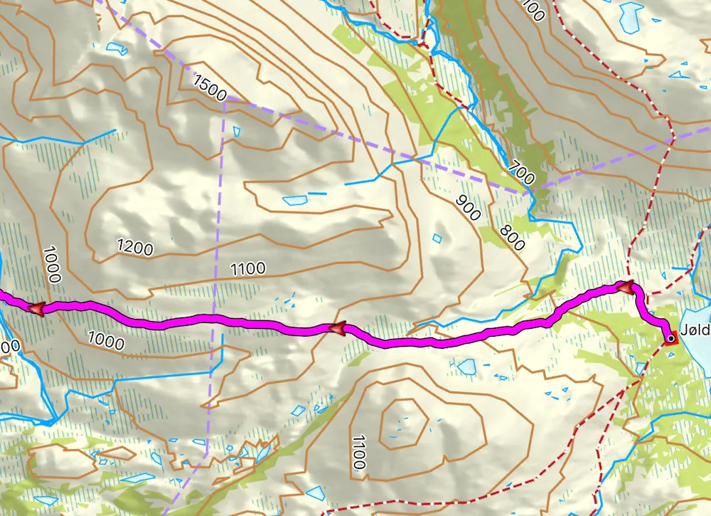
    Use the route planner to find the quickest route. GPS will put up a route along paths and roads.

  • Image

    Search for places

    Thousands of place names are stored in the map, so that you can easily find them.

  • Always updated

    We updates the map every month, so your maps are always up to date.Property limits are updated yearly. You can freely download the new updated maps for one year. After a year, you can still use the map you have downloaded. Or you can choose to continue the subscription for 99 NOK 12 new months. The map was last updated 28/05/24.

  • Try before you buy

    If you want, you can try first by downloading the map for a free municipality.
    Try a map of a municipality for free here.

  • We give 10% to charity

    We give 10% of our income to Effective Altruism Norway

  • Buy once, use forever

    You can use the map as long as you would like without paying anything more. If you wish you can later update the map for 99 NOK per year.

  • Use one license on all your devices.

    Do you have multiple devices? Nice! You can use one license key on all you devices.

  • 100% satisfied

    We will refund your purchase if you are not satisfied within 30 days.

Supported devices

The devices under can use maps from Kartmannen. We have not tested all devices. We'll refund your purchase if you fail to get the map to work on your device. Please contact us here if you can not find your device or find errors in the list below.
Alpha®
  • Alpha® 50
  • Alpha® 100
  • Alpha® 200
  • Alpha® 200i
  • Alpha® 300
  • Alpha® 300i
Astro®
  • Astro® 320
  • Astro® 430
  • Astro® 900
Atemos®
  • Atemos® 50
  • Atemos® 100
Colorado®
  • Colorado® 300
  • Colorado® 400
D2™
  • D2™ Charlie
  • D2™ Delta
  • D2™ Delta PX
  • D2™ Delta S
Dakota®
  • Dakota® 20
Descent™
  • Descent™ Mk1
  • Descent™ Mk2
Edge®
  • Edge® 520 Plus
  • Edge® 530
  • Edge® 605
  • Edge® 705
  • Edge® 800
  • Edge® 810
  • Edge® 820
  • Edge® 830
  • Edge® 1000
  • Edge® 1030
  • Edge® 1040
  • Edge® Explorer 820
  • Edge® Explorer 1000
  • Edge® Touring
  • Edge® Touring Plus
epix™
  • epix™ Gen1
  • epix™ Gen 2
  • epix™ Pro Gen 2
eTrex®
  • eTrex® 20
  • eTrex® 20x
  • eTrex® 22x
  • eTrex® 30
  • eTrex® 30x
  • eTrex® 32x
  • eTrex® Touch 25
  • eTrex® Touch 35
fēnix®
  • fēnix® 5 Plus
  • fēnix® 5S Plus
  • fēnix® 5X
  • fēnix® 5X Plus
  • fēnix® 6
  • fēnix® 6S
  • fēnix® 6X
  • fēnix® 7
  • fēnix® 7S
  • fēnix® 7X
  • fēnix® 7 Pro
  • fēnix® 7S Pro
  • fēnix® 7X Pro
Forerunner®
  • Forerunner® 945
  • Forerunner® 955
  • Forerunner® 965
DriveTrack™
  • DriveTrack™ 70LM
  • DriveTrack™ 71
GPSMAP®
  • GPSMAP® 62
  • GPSMAP® 62s
  • GPSMAP® 62sc
  • GPSMAP® 64
  • GPSMAP® 64s
  • GPSMAP® 64st
  • GPSMAP® 64sx
  • GPSMAP® 64x
  • GPSMAP® 65
  • GPSMAP® 65s
  • GPSMAP® 66i
  • GPSMAP® 66s
  • GPSMAP® 66sr
  • GPSMAP® 66st
  • GPSMAP® 67
  • GPSMAP® 67i
  • GPSMAP® 76
  • GPSMAP® 78
  • GPSMAP® 78s
  • GPSMAP® 276Cx
MARQ™
  • MARQ™ Athlete
  • MARQ™ Aviator
  • MARQ™ Captain
  • MARQ™ Driver
  • MARQ™ Expedition
Montana®
  • Montana® 600
  • Montana® 610
  • Montana® 610t
  • Montana® 650
  • Montana® 650t
  • Montana® 680
  • Montana® 680t
  • Montana® 700
  • Montana® 700i
  • Montana® 750
  • Montana® 750i
Oregon®
  • Oregon® 200
  • Oregon® 300
  • Oregon® 400t
  • Oregon® 450
  • Oregon® 450t
  • Oregon® 550
  • Oregon® 550t
  • Oregon® 600
  • Oregon® 600t
  • Oregon® 650
  • Oregon® 650t
  • Oregon® 700
  • Oregon® 750
Rino®
  • Rino® 650 Nordisk
tactix®
  • tactix® Charlie
  • tactix® Delta
  • tactix® 7
  • tactix® 7 Pro
quatix®
  • quatix® 6
  • quatix® 6x
  • quatix® 7
  • quatix® 7x

Unsupported devices

Astro®
  • Astro® 220
Edge®
  • Edge® 520
GPSMAP
  • GPSMAP 60C
  • GPSMAP 60CS
  • GPSMAP 60Cx
  • GPSMAP 60CSx
  • GPSMAP 76C
  • GPSMAP 76CS
  • GPSMAP 76Cx
  • GPSMAP 76CSx
eTrex®
  • eTrex® Legend C
  • eTrex® Legend Cx
  • eTrex® Legend HC
  • eTrex® Legend HCx
  • eTrex® Venture Cx
  • eTrex® Vista Cx
  • eTrex® Vista HCx
inReach
  • inReach Explorer®

How do I install the map

A license key will be sent to you by email after you have bought the map. You will the need to install an application from us. The application will guide you further on how to install the map directly to you GPS and PC/Mac (i BaseCamp™).